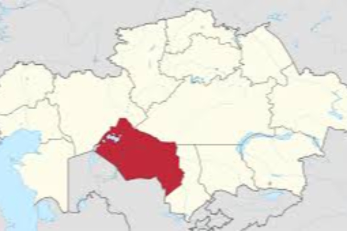
Kyzylorda region was founded on January 15, 1938. Kyzylorda region is an administrative-territorial unit located in the south of the Republic of Kazakhstan. It borders with several regions of the Republic of Kazakhstan, including Turkestan region to the East and South-East, Karaganda region to the North, Aktobe region to the Northwest and the Republic of Karakalpakstan to the Southwest, and Navoi region of Uzbekistan to the South. The area is 226 thousand km² .
Kyzylorda region consists of Aral district, Zhalagash district, Zhanakorgan district, Kazaly district, Karmakshy district, Syrdarya district, Shieli district and the city of Kyzylorda.
Geography
The region is located in the east of the Aral Sea specifically at the lower reaches of the Syrdarya River. The main part of the territory is located in the Turan lowland (height 50-200 m).
- the western part of the region is bordered by the Aral Sea;
- in the south-east and north-west there are mountain ridges and plains of Karatau;
- to the West – the dunes of the Karakum Aral Sea.
	On the left bank of the Syrdarya there are hills and wide plains of the Kyzylkum soil, crossed by dry channels of the Zhanadarya and Kuandarya rivers, on the right bank there are plateaus (Egizkara, 288 m.), sandy areas (Aryskum and others), shallow pits full of salt. In the north there are massifs of sand dunes (Little Barsuk and Karakum soils). In the south-eastern part, the territory of Kyzylorda region includes the Karatau mountain ranges (up to 1419 m. high).
	A large part of the territory is covered with low vegetation soils; ie wormwood in hardened areas, salt-tolerant plants, unstable plant varieties in sandy and saline soils in spring; The dunes grow among the sands. The sand dunes are covered with saxaul, comber, sagebrush and wormwood.
The climate is quite dry and continental.
The climate of Kyzylorda region is sharply Continental, with long-term hot summers and short-term cold with little snow. Such a climate regime is characterized by its location within the Euroasian continent, proximity to the southern zone, the specifics of atmospheric variability, and other factors.
Flora and fauna
A large part of the region is covered with sand. The soil is brown, sandy gray, saline. Sagebrush, betezha, saxaul, zhingyl, willow, torangy, reeds are cultivated. 12% of the territory suitable for agriculture is located in the floodplain of the Syrdarya River, 23%-in the wilderness, 65%-in the desert zone.
White antelope, onager, goitered gazelle, wolf, fox, rabbit, corsac fox, jackal, jerboa, ferret, gopher live in the animal world. Among the birds, there are golden eagles, hawks, pheasants, geese, ducks and fish in the lakes include perch, carp, wels catfish and sturgeon.
History
The administrative center of the region is the city of Kyzylorda, located in the south of Kazakhstan. As a fortress of the Kokand Khanate, Akmeshit was built in 1817 on the Left Bank of the Syrdarya River on the caravan route from Tashkent, Bukhara and Khiva via Atbasar to Western Siberia, through Turgai to Troitsk, to the Orenburg province. In 1818, the fortress was moved to the Right Bank of the river, and the foundation of the city of Akmeshit was laid as the first mound. The fortress was named Akmeshit after the white brick mosque. In 1853, the city was named Perovsk, and in 1867 it became the center of the Syrdarya district.
In 1921, the Syrdarya region consisted of 7 counties: Aulieata, Kazaly, Myrzashol, Tashkent, Turkestan, Shymkent, and Perovsk.
On October 12, 1922, by the resolution of the All-Union Central Executive Committee, Perovsk uyezd was renamed Akmeshit uyezd, and Perovsk was renamed Akmeshit.
On December 12, 1924, the Syrdarya province was formed with Shymkent as its center. The Syrdarya province included Kazalinsky and Kyzylorda counties.
In 1925, the new capital of Kazakhstan was renamed as Kyzylorda, and until 1928, the city of Kyzylorda was the capital of the Kazakh ASSR.
On January 17, 1928, Kazaly, Kyzylorda districts, Karsakpay district and 8 districts of Syrdarya province were merged to form Kyzylorda. The city of Kyzylorda became the center of the newly formed Kyzylorda district.
By the decision of the Supreme Soviet of the USSR on January 15, 1938, the Kyzylorda region was established.